Reconnecting with Our Wetlands

eeBLUE: Watershed Chronicles
This post was written by Polly Burns, Program Director at ReNEW Schools, and Dinah Maygarden, Director of the Coastal Education Program at the University of New Orleans.
The University of New Orleans Pontchartrain Institute of Environmental Sciences has partnered with the ReNEW Schools 21CCLC program in New Orleans, Louisiana to bring wetland and watershed science investigative projects to middle school students living in the climate-vulnerable neighborhoods of New Orleans East.
In the years following Hurricane Katrina, local students were inundated with lessons on the importance of coastal marshes for protecting the city from storm impacts, and the need for, but danger in reliance upon, levee systems that control regional water flow. But today, more than 15 years from this devastating event, we find students who struggle to define the purpose of a levee or the benefits of marshlands, and who are unaware that their schools and communities depend upon the existence of both. With this program, we have sought to reconnect students with the delicate wetland watershed on which their communities depend.
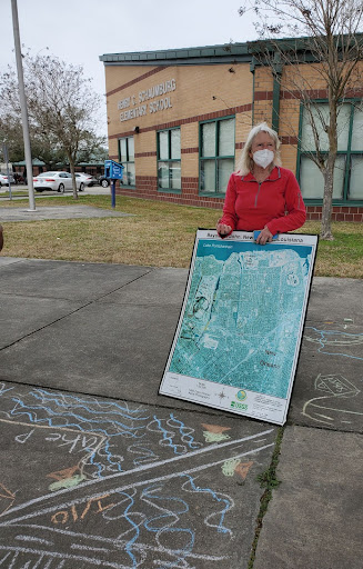
During our first year, because we were unable to explore in person, students began by investigating the spatial relationships between their schools and wetlands using digital maps, and met virtually with their 21CCLC peers and instructors to discuss topics such as wetland ecosystem interdependence, the role of levees and wetlands in storm control, the connections between litter, street flooding, and marine debris, and the role plants play in reducing urban flooding.
Students at each of the two 21CCLC sites then determined their own course of in-depth investigation of these topics, drawing from their personal experiences and observations. Students from Schaumburg Elementary decided to explore the potential connection between plastic litter on city streets and marine debris in the Gulf of Mexico. Students at Dolores T. Aaron Elementary chose to investigate the role of urban plants and trees in mitigating street flooding, a common issue across the city of New Orleans.
Students investigating plastic pollution used Google’s Tour Builder to create digital maps tracing the journey of litter from nearby storm drains, through city drainage pipes and canals, to an open basin or bayou in their watershed—connecting the city streets to the Gulf of Mexico. Students then explored the ways in which plastic pollution can affect the basin’s ecosystem and, ultimately, join the patches of debris threatening marine life in the Gulf. This digital tool turned out to be very beneficial conceptually for the students, and can be seen as a positive contribution to the program from the otherwise deleterious pandemic restrictions.
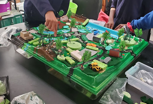
Once in person, students in both programs used Enviroscape wetland models to explore how rainwater moves across landscapes, lifting and carrying pollution as it flows. Students then examined the landscaping and hardscaping on their campuses, measuring slope and groundcover permeability to identify areas that contribute to flooding. We also use the Enviroscapes as a platform for students to design and build their own marshes, rain gardens, and levees around an urban environment, helping to bring these features and the vital roles they play to life for students once again.
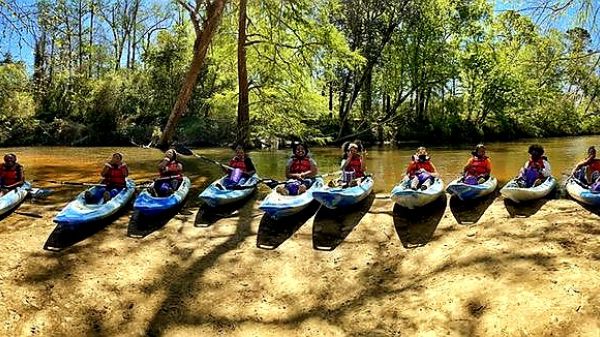
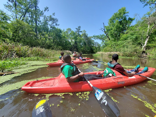
With in-person field trips back in play, students have been exploring the lakes and bayous in and around the city, using LaMotte water chemistry kits to monitor for evidence of agricultural, residential, and industrial pollutants related to stormwater runoff. These hands-on projects on-and-off campus, supported by digital mapping exercises, have made clear for students the interconnectedness of their daily actions and the watershed around us.
While the pandemic restricted us to online, and then on-campus, activities only for the first year and a half, the progression from foundations to field work has been illuminating for students, and allowed time for 21CCLC instructors to concentrate some effort on professional development as well.
With a newfound sense of concern for the impacts of runoff pollution, students expressed that they wanted to make a positive impact by educating younger students in the 21C program, and to draw new interest toward watershed stewardship in a fun and positive way. We are excited at the potential for these students to continue learning, teaching each other, and growing with the tools and knowledge this program has given to the 21CCLC programs at ReNEW!
The NOAA Office of Education and NAAEE partnered to increase environmental and science literacy among NOAA’s partners and external networks. In this five-year partnership supported by the U.S. Department of Education, NOAA and NAAEE worked together to provide enriching after-school watershed-related STEM (science, technology, engineering, and mathematics) projects through NOAA-21st Century Community Learning Centers Watershed STEM Education Partnership grants. These grants supported programming for a total of 100 local 21st Century Community Learning Centers (21st CCLC) sites and their students. The 30 selected projects served 18 states, ranging from Alaska to Florida.
Comments
T'Noya —
Thanks for posting this, and especially for sharing how the 21CCLC team was able to pivot and do some engaging work with students despite the limitations of the pandemic!
If any readers are interested in doing something like the streets-to-Gulf digital mapping project, Google has stopped supporting Google Tour, BUT Google Earth projects offers similar functions.
Thanks for giving us some details, T'Noya!